


Above Everywhere are licensed & insured aerial video & photography specialists. Utilising remote-controlled quadcopters / multi-rotor UAVs / drones.
Above Everywhere can offer drone mapping services for your property and land.
We operate throughout the Caribbean in the United Kingdom. We are available to work worldwide, from 1 acre, to 10,000 acres and more.
Our services are explained below :-
Orthomosiac Mapping
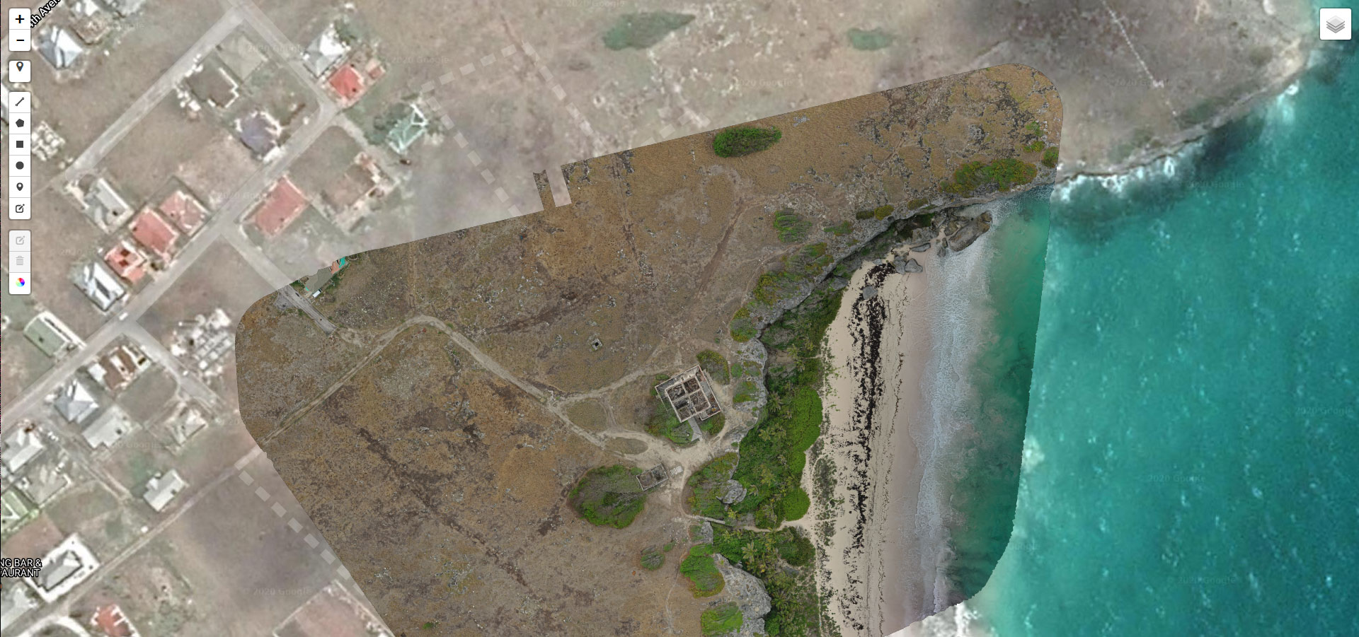
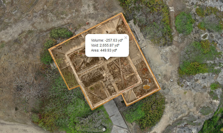
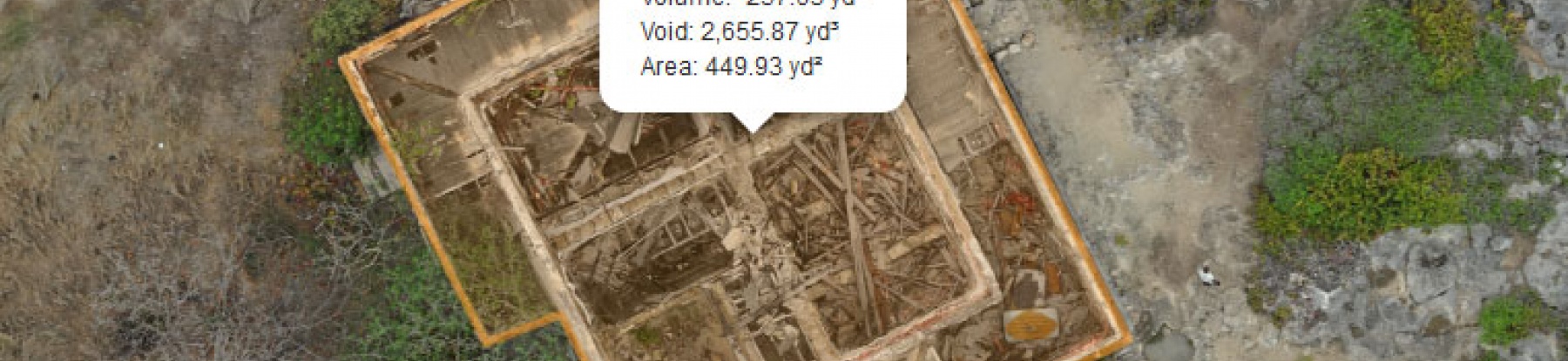
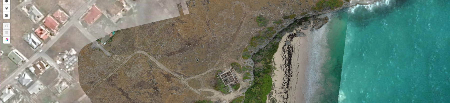
We can map your property in high resolution (up to 1.08cm/pixel GSD) resulting in composite imagery that can be used for a variety of purposes. With our interactive platform you can overlay the map on Google Maps, Earth or any mapping platform you wish. You can accurately measure distances, heights, volumes and obtain precise coordinates. These maps can be viewed online or offline and if wished can be animated over time to show any changes through the duration of a project.
Where required, we can interact with precise ground control points, further increasing the accuracy of the mapping operation.
>> Download Sample Orthomosiac JPG (70Mb, 2.0cm/pixel GSD)
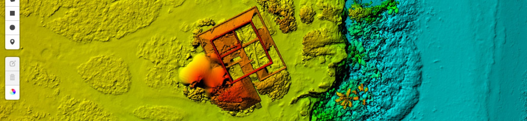
Digital Surface Models
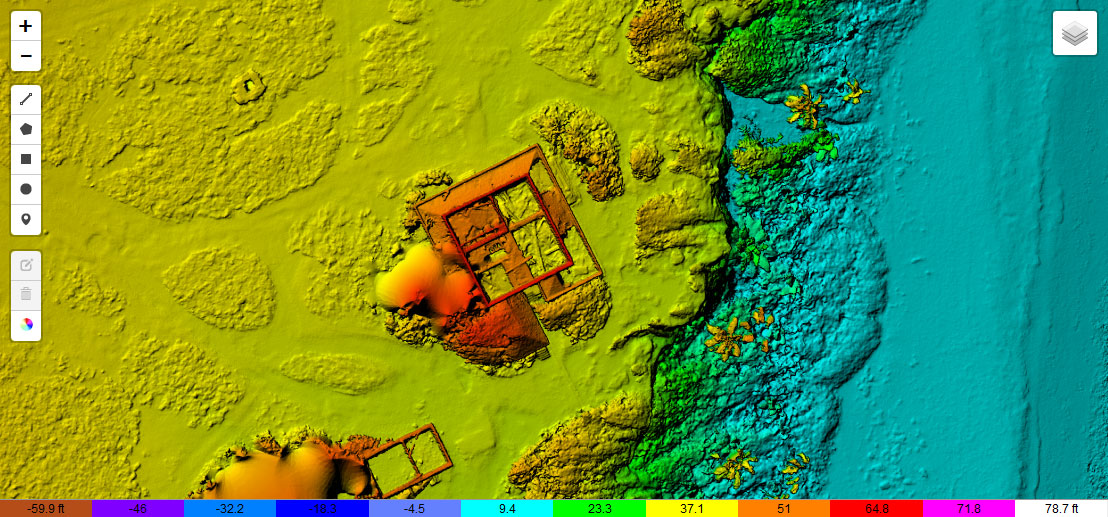
This model shows the relative heights of the property in question. This model has a variety of uses, from calculating volumes of land/excavation, examining drainage paths and more.
>> Download Sample Elevation JPG (9Mb)
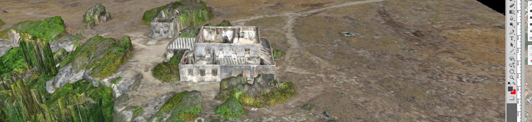
3D Modelling
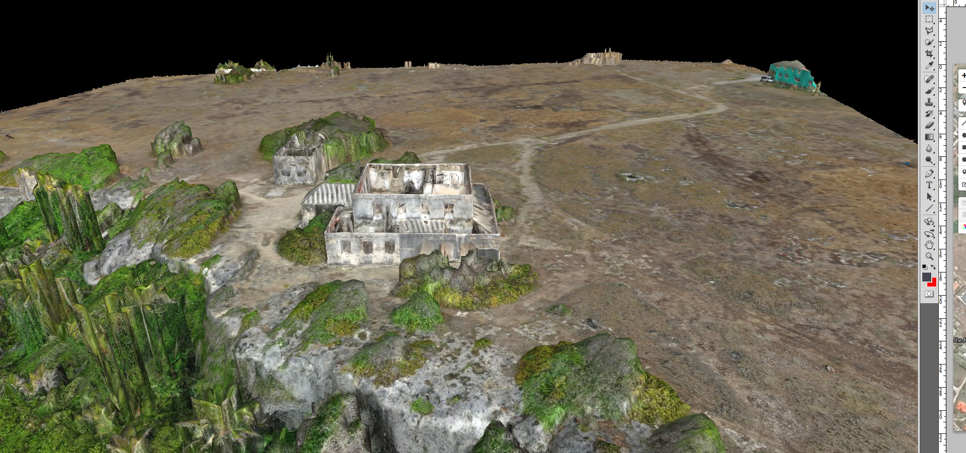
Using photogrammetry, 3D models can be provided which allow a fully interactive view to be rotated, zoomed and manipulated viewing all angles of the property in question.
Deliverables
All our models are deliverable in TIF, JPG, KMZ, Point Cloud (LAS/TXT), 3 Model (OBJ/MTL) as desired.
Contact Us today to discuss how we can help deliver your solution.